Rare August Snow Clips Montana's Peaks; Explanations For The Saharan Rains; + Earth's Oceans Are Cooling Fast, And Scientists Have Yet To Come Up With A Party-Approved Reason Why
The models fail to account for the chaotic and non-linear nature of the climate system. It gets them every-time.
Rare Summer Snow Clips Montana's Peaks
Montana got an early taste of winter this week. The NWS even issued a Winter Weather Advisory for Glacier National Park and the Mission Mountains, as an unusual August snowstorm swept through the region.
On Wednesday, August 28, a myriad of Montana ski areas reported fresh accumulating snow.
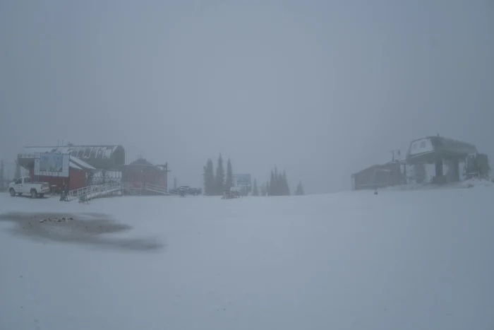
Whitefish Mountain Resort was one of them. By 10 AM, noteworthy snow was settling as low as 5,800 feet, including at the resort's upper terminals of Chair 1 and Chair 7:
"This has got to be a new record,” remarked Chad Sokol, Whitefish’s Public Relations Manager. "An unheard-of late-August squall delivered a solid inch of snow to the summit this morning, along with a visible dusting across the upper 1,000 feet of Big Mountain. ... measurable snow this time of year? We didn’t see that coming."
Whitefish wasn’t alone. Bridger Bowl Ski Area also reported its first snow of the season, as did a host of others.
The storm actually intensified at Glacier National Park’s Logan Pass. By late-morning, the NWS reported increasing snowfall rates, with forecasts predicting between as much as 7 inches of snow at the Logan Pass Visitor’s Center by day’s end.
This is the same Glacier National Park (GNP) that, back in late-2019, was forced to take down all of its visitor center signs that declared glaciers at the Park would be disappeared by the year 2020 due to the ravages of global boiling.
All signs were sheepishly pulled from its displays after the computer models it relied upon from the early 2000s, which foretold of unending glacial retreat, turned out to be garbage-in garbage-out.
"Larger than average snowfall over several winters slowed down that retreat rate and the 2020 date used in the display does not apply anymore," said the USGS at the time, an agency tasked with monitoring the glaciers at GNP.
Since then, an all-time record-smashing snow season hit in 2022-23. This was followed by the well-above-average season just gone. And now, 2024-25 appears to have started in earnest, in August! -- an early taste of winter that has certainly stirred the excitement. As one Instagramer put it, "I’ve seen enough. Open the lifts."
Explanations For The Saharan Rains
Rain is reaching deep into the Sahara Desert, specifically along the Algeria-Mali border—an area that usually sees very little precipitation. This time, the rain is arriving from the south, an unusual direction for this region. While not unprecedented, this is far from typical.
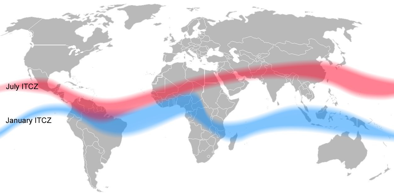
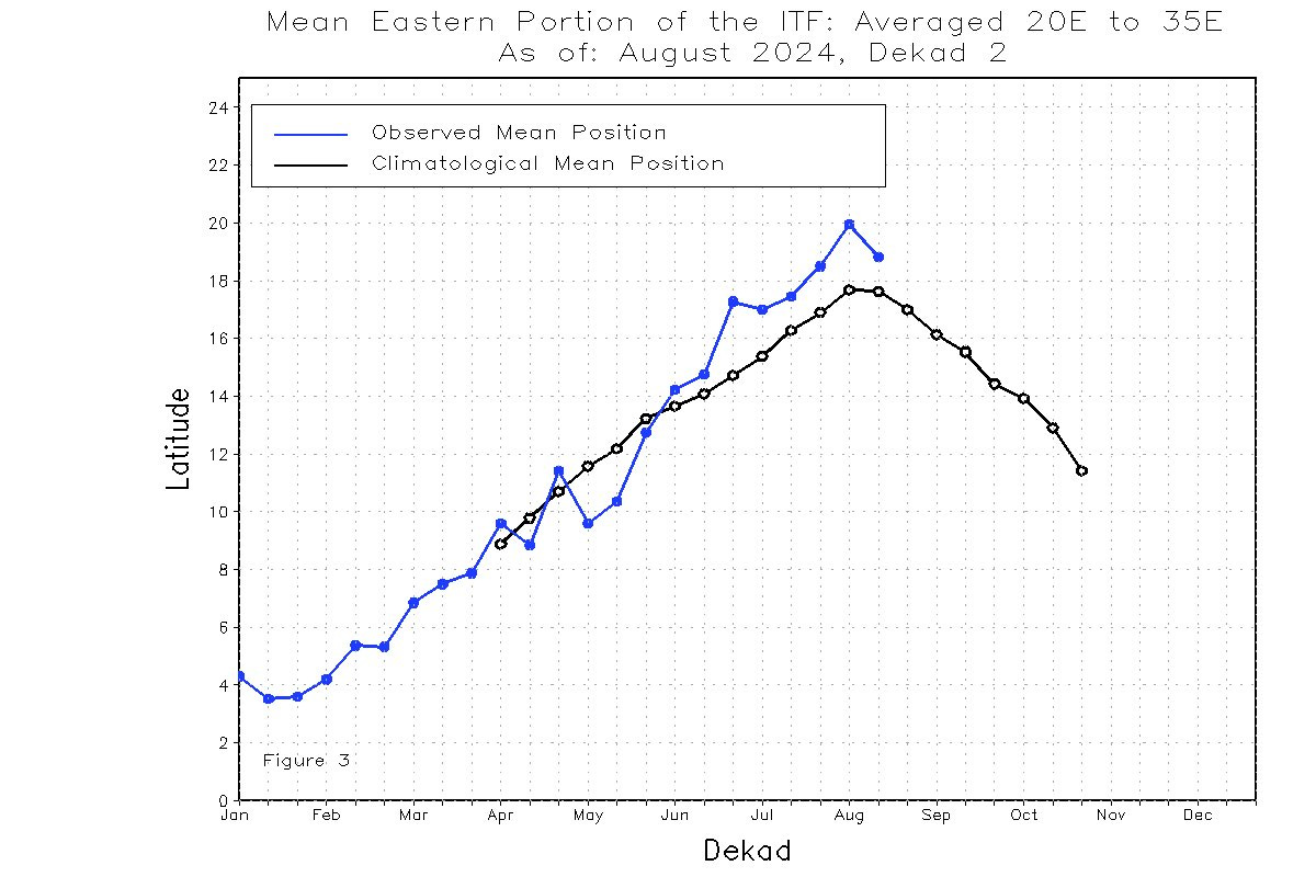
Some point to the shifting of the Intertropical Convergence Zone (ITCZ) as being the culprit, a band near the equator where winds from the Northern and Southern Hemispheres meet that plays a significant role in global weather patterns.
When the ITCZ moves north, it can push warm, high-pressure air from Africa into Europe, replacing it with fronts from the south.
Its recent northerly positioning may have also contributed to a pocket of southern Europe experiencing heatwaves this summer.
Shifting focus to the Atlantic, the 2024 hurricane season has, thus far, been a dud, with far fewer storms developing than 'experts' were expecting—not least Michael Mann, who forecast a record 33 name storms (as of August 29 we're at 5).
Keep reading with a 7-day free trial
Subscribe to Electroverse Substack to keep reading this post and get 7 days of free access to the full post archives.


